
Philip’S Rgs Junior School Atlas
Kshs 1,900.00
Kshs Loading...
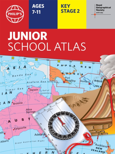
The 11th edition of the market-leading atlas for primary school pupils, Philip’s RGS Junior School Atlas has been fully revised and updated with all the latest facts and curriculum requirements.
– The essential atlas for primary schools with clear and easy-to-follow maps and diagrams – updated for 2021/2022- Published in association with the Royal Geographical Society- Recommended for Key Stage 2 of the National Curriculum – and all 7-11 year olds – An excellent introduction to mapping concepts such as scale, direction, symbols, longitude and latitude- 22-page Britain and Ireland section with clear thematic charts, diagrams and large-scale regional maps- 22-page section on The World, with political maps – and thematic treatment of key themes, from volcanoes and earthquakes to transport and tourism- Continents section with physical and political maps- Easy-to-follow map references and 1,000-place indexThe market-leading atlas for pupils at primary schools, Philip’s RGS Junior School Atlas is a stimulating and authoritative first introduction to the world of maps, and is recommended for Key Stage 2 of the National Curriculum.
The introductory section describes the meaning of scale, how to measure distances using the maps, and explains the symbols on the maps. The following section is devoted to the United Kingdom and Ireland. Thematic maps cover topics such as mountains and rivers, climate and weather, population and cities, farming and fishing, industry and energy, transport, tourism and conservation. Regional maps of England and Wales, Scotland and Ireland complete this section. The rest of the atlas is made up of world thematic maps and world continental maps. Included are topics such as the world’s climate, vegetation, agriculture, energy sources, and environmental concerns, such as global warming. A simple letter-figure index completes the atlas – a useful introduction to help the young reader find his/her way around the maps. Available in both Hardback and Paperback editions.
Format: Hardback 64 pages
Classifications: Classifications:
For National Curriculum Key Stage 2, World atlases / world maps, Educational: Geography, Atlases & maps (Children’s/Teenage)
ISBN : 9781849075794
Published : 27 Oct 2021
Author : Philip's Maps
Size : 370 x 230 x 10 (mm)
Weight : N/A
Out of stock
Delivery Information
We strive to ensure all orders are processed and delivered promptly.
- Order Processing: Orders are processed within 1–2 business days upon confirmation of order & payment.
- Delivery Timeline: Standard delivery typically takes 1–3 business days, depending on your location and courier availability.
- Shipment Updates: Once your order is dispatched, our sales agent shall contact you regarding the progress of your delivery.
- Delays: While we aim to deliver on time, unforeseen delays may occur due to customs clearance, courier challenges, or external factors. We will keep you updated should any delays arise.
Returns & Exchanges
We value your satisfaction and aim to make returns as smooth as possible.
- Eligibility: Items may be returned within 7 days of delivery, provided they are unused, in original packaging, and accompanied by proof of purchase.
- Non‑Returnable Items: Certain items such as story books / novels, offer / clearance products, personalized orders cannot be returned.
- Return Approval: All return requests must be reviewed and approved by our team before the item is sent back.
- Return Shipping: Return shipping costs are the responsibility of the customer unless the item received was damaged, defective, or incorrect.
- Refunds: Approved refunds will be processed within 5–7 business days after the returned item is inspected. Refunds are issued through the original payment method.
- Exchanges: If you wish to exchange an item, please contact us to confirm availability via our official EYS WhatsApp / call on +254 726 522 108.